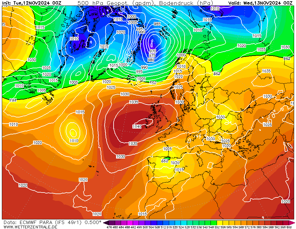
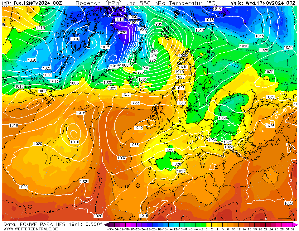
Toggle navigation
Top Karten
Global models
GFS
ECMWF
UKMO
GEM
ICON
ARPEGE
NAVGEM
JMA
Regional models
WRF
ICON D2
HARMONIE
AROME
ALARO
COAMPS
IRIE
Data-driven models
AIFS
GraphCastGFS
Other
9-panel
Multi Model
Bodenkarten/Fax
Waves
CFS
Model status
Observations
METAR
SYNOP
SST
Radiosonde
Diagrams
Global models
GFS
ECMWF
UKMO
GEM
ICON
ARPEGE
NAVGEM
Ensemble
GFS
ECMWF
GEM
ICON
Regional models
WRF
ICON-D2
HARMONIE
AROME
IRIE
Data-driven models
AIFS
GraphCastGFS
Multi Model
City selection via map
Grid point selection via map
Skew-T diagrams
Archive
Reanalysis
CFSR
(1979-now)
ERA
(1900-2010)
NOAA
(1836-2015)
FAX
NCEP
UKMO
DWD
GFS analyse
Radar
Satellite
Observations
Weather data
Extremes
Station map
Forum
About
Deutsch
English
Nederlands
EspaƱol
ECMWF
Currently selected.
GFS
The selected variable and region is available, but not for 2024-11-12, 06:00. You will switch back to the first available time step.
Large-scale
500 hPa Geopot. Height
850 hPa Temp.
850 Hpa Stream lines
300 hPa Wind
200 hPa Wind
850 hPa Temp. deviation
Surface
2m Temp.
10m Wind
Precipitation
Precipitation
Accumulated Precip.
Continental
Europe
Northern Hemisphere
North America
Southern Hemisphere
South America
Africa
Eastern Asia
Southern Asia
Australia
Regional
Central Europe
Scandinavia
Member:
OP
AVG
PARA
SPR
24
Wed 13 Nov 00:00
48
Thu 14 Nov 00:00
72
Fri 15 Nov 00:00
96
Sat 16 Nov 00:00
120
Sun 17 Nov 00:00
144
Mon 18 Nov 00:00
168
Tue 19 Nov 00:00
192
Wed 20 Nov 00:00
216
Thu 21 Nov 00:00
240
Fri 22 Nov 00:00
Run:
00
12
Interval
3
6
12
24
help
Download GIF
click
Load all maps
Single-variable mode
You are now in the multi variable mode. Select all the variables of interest and they will be plotted side-by-side in a grid.
0% Complete
URL of this map